Administrative Infrastructures
https://centerforspatialresearch.github.io/admin_infrastructure/
August 2021
QGIS, Python, JavaScript, Mapbox

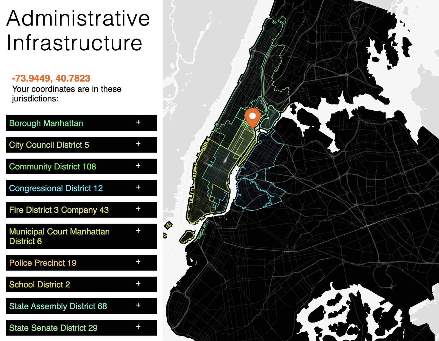
This map depicts the tangled lines of this map represent 10 layers of administrative jurisdictions covering New York City. If we live in New York City, then we live in a place where these boundaries align and diverge.
Each map layer depicts a set of borders marking different fire companies, police precincts, schools, community boards, municipal courts, congressional districts, the state assembly and senate, as well as city council.
In some places, the boundaries overlap exactly. These agreements are often found along natural physical borders of water. One example of this convergence is below - Rikers Island in which all boundaries overlap exactly.

In other places, jurisdictions intersect and overlap without seeming to be aware of each other. Below here is a part of the Bronx where very little is in agreement, and walking a few blocks means traveling through largely different set of jurisdictions at each corner.

This map of administrative boundaries serves 2 functions. The first is utilitarian, by clicking on a location or searching for a street address, the user is shown all the jurisdictional boundaries that covers the place they have chosen.
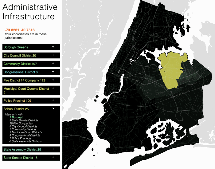
The second reason I built this map is to encourage the visual exploration of how different types of administrative boundaries behave. Jurisdictions serving different needs carve up the city differently. Fire companies, school districts, and police precincts have to take into consideration physical infrastructure and proximity. The political boundaries of congress, state assembly, and senate by comparison replace physical constraints with demographic ones. Another set of boundaries representing community boards and city council resembles a hybrid of the first 2. Yet all 3 groups of jurisdictions, with differing purposes, agendas and types of participation, inevitably contain every resident and place in the city.
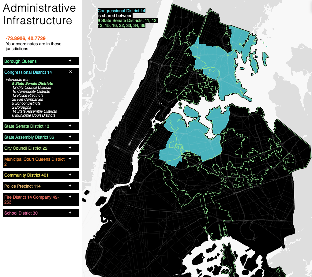
It is no surprise that carefully crafted political boundaries stand out as oddly shaped. Here in my home neighborhood in Queens, I am represented by Congressional District 14. Using this. map, I can see that in addition to being shared between the Bronx and Queens, it also intersects with 14 State Assembly districts, and 9 State Senate seats as well as 6 Municipal Courts, 16 Community Boards, and 12 City Councils Districts.
Use this map to find your jurisdictions, and how they allow you to share the rest of the city.